
The Bay Area company map
A regional illustration with 23 featured companies and source links.
Three maps. Twelve places. From garden courtyards to museum galleries and the Pacific coast, find a new direction for your next outing from Atherton.
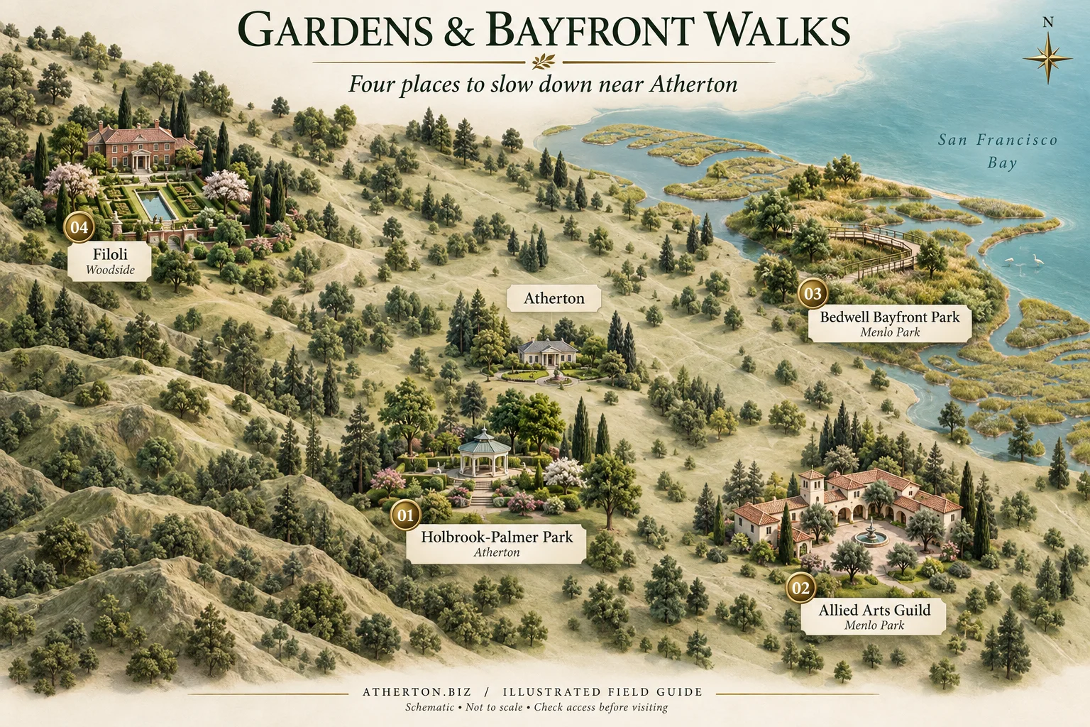
Stay close with a garden pause in Atherton, browse a creative courtyard in Menlo Park, or trade the town setting for bayfront open space and Woodside's formal gardens. Choose one destination rather than treating these four places as a walking circuit.
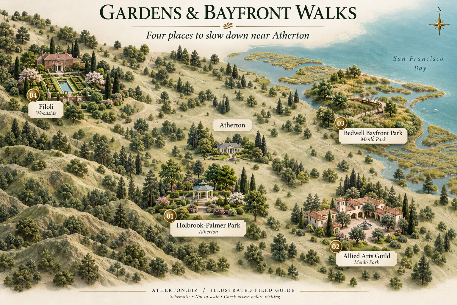
Atherton's municipal garden park offers walking paths and a leafy setting for a quieter break.
Before you go: The Town's page still displays a playground renovation notice beginning May 4, 2026. Reopening has not been confirmed here; check before planning a playground visit.
Gardens, studios and Spanish Colonial Revival architecture make this a natural choice for an art-and-garden outing.
Before you go: Check visitor information and individual shop or cafe schedules. A gallery visit, a meal and a private event are separate arrangements.
A bayfront nature park for walking and wildlife watching, with a very different feel from the Peninsula's formal gardens.
Before you go: Confirm gate hours, trail conditions and access needs with the City. Use designated paths rather than the imagined paths in this illustration.
A historic house, formal gardens and natural lands offer a more expansive garden-focused destination beyond Atherton.
Before you go: Filoli recommends advance ticket reservations. Check the selected day's admission, events and trail access before setting out.
Pair two neighboring Stanford art museums, explore aviation in San Carlos, or follow computing's story in Mountain View. These are public-facing cultural destinations, not invitations to tour private company campuses.

Stanford's art museum brings collections, exhibitions and public programs into one campus destination.
Before you go: Consult the museum's visiting information and Stanford parking guidance. Campus parking and museum admission are different things.
A museum of modern and contemporary American art, close to the Cantor in Stanford's arts district.
Before you go: Check the museum's own calendar and visitor guidance; do not assume its schedule matches the Cantor's.
An aviation-focused museum at San Carlos Airport, with aircraft exhibits and additional scheduled activities.
Before you go: Check admission and activity availability. Enter through the museum's public entrance; never use airport runways as pedestrian shortcuts.
Explore computing history at the museum on North Shoreline Boulevard, rather than trying to visit a private technology office.
Before you go: Check museum hours, special closures and exhibit tickets. Programs and demonstrations may follow separate schedules.
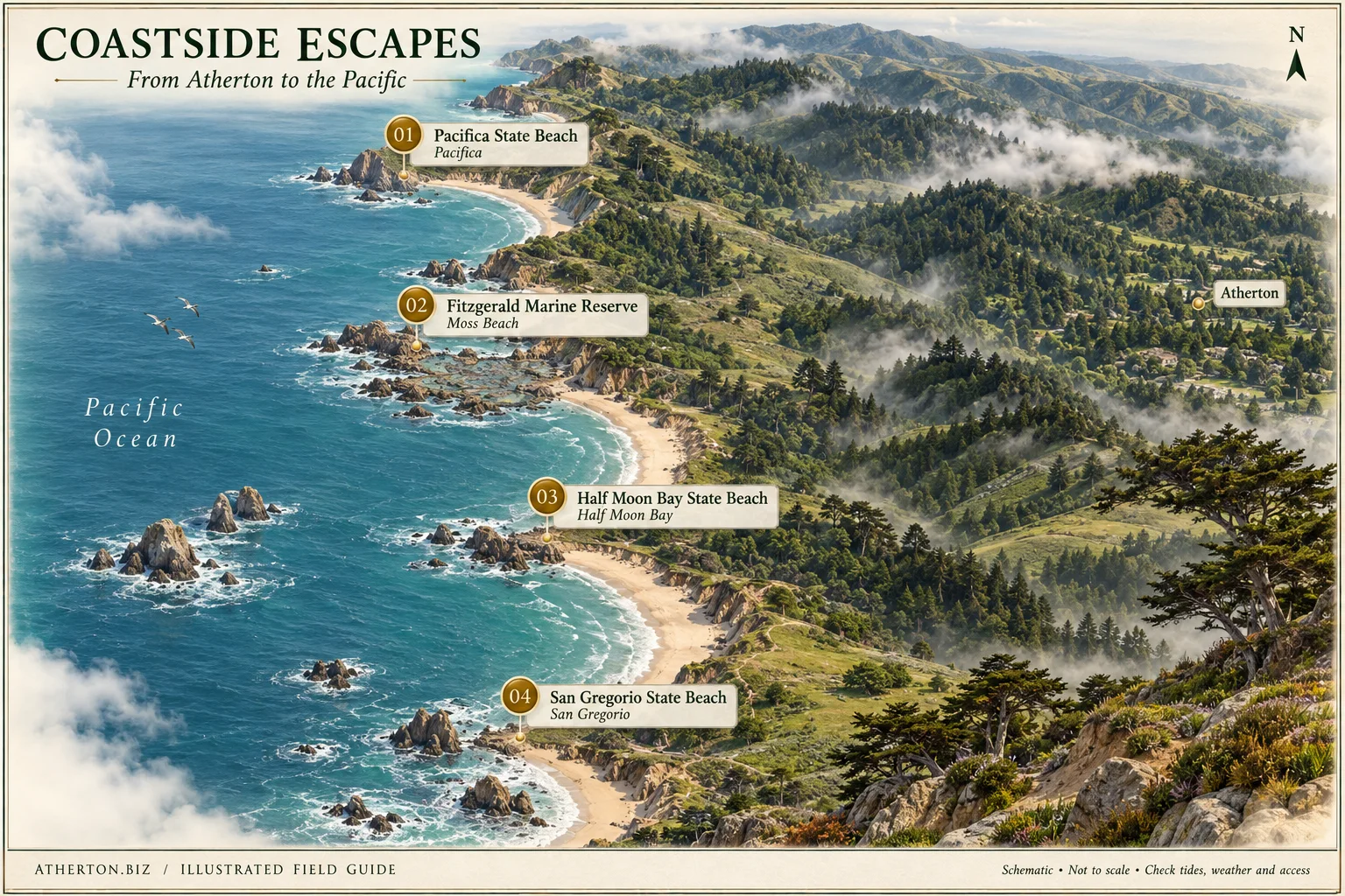
Look west across the Peninsula for a different landscape. The map follows four coastal destinations from Pacifica south to San Gregorio, with Atherton as an inland reference point. These are separate outing ideas, not a recommended single-day itinerary.
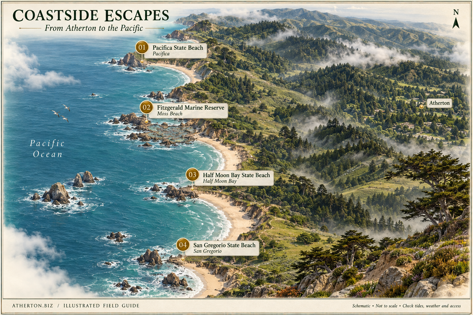
Also known as Linda Mar Beach, this coastal destination includes an oceanfront recreation trail.
Before you go: Check the City's beach guidance, parking and current conditions. This guide does not assess swimming or surfing safety.
A protected rocky shoreline and intertidal habitat, best approached as a place to observe wildlife without disturbing it.
Before you go: Check tides, closures and reserve rules. Do not touch or remove marine life, rocks or shells; follow posted wildlife restrictions.
A state-beach destination for ocean views and coastal walks. Choose a specific beach access point using the official park information.
Before you go: Verify access, parking and notices with California State Parks. Cold water, changing surf and rip currents require caution; this is not a swimming recommendation.
Farther south, a sandy shore, coastal bluffs and a protected estuary offer a different coastal setting.
Before you go: Check current parking notices and beach rules. Stay out of protected habitat and use official access; do not rely on the illustrated coves.
Numbers match the destination key beneath each image, not a recommended visiting order. We chose public-facing places with first-party visitor information. Only Holbrook-Palmer Park is in Atherton; the other stops are in neighboring Peninsula communities or on the San Mateo Coast.
Names, regional locations and visitor references were checked on September 27, 2026. We do not monitor live closures, tides, traffic, admission availability or accessibility. No travel times, property boundaries or safe coastal routes are implied. Contact the operator about your specific access needs and follow posted instructions.
Download an illustration to plan your next outing or share this source-linked page. The institutions featured have not endorsed these maps. Suggest a correction or another destination.
A regional illustration with 23 featured companies and source links.
Explore Silicon Valley's history through an interactive map and timeline.
Explore public-source stories of philanthropy connected to Atherton.